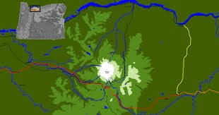
Sandy Oregon is a suburb of Portland.
When I think of Sandy Oregon, I think of going up to Mt Hood. It is really the gateway to Mt Hood. When the kids were young we would always stop in Sandy on our way up to ski, so we could get gas, or snacks, because it is the last real town before you get up into the mountains! Sometimes there would even be snow there, the 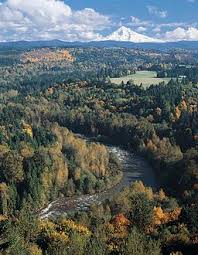 elevation is 1000 feet! It is a pretty big town, with lots of restaurants, shops, grocery stores etc, mostly forested foothills, but open farmland and some little valleys too.
Where Sandy River meets the Columbia River
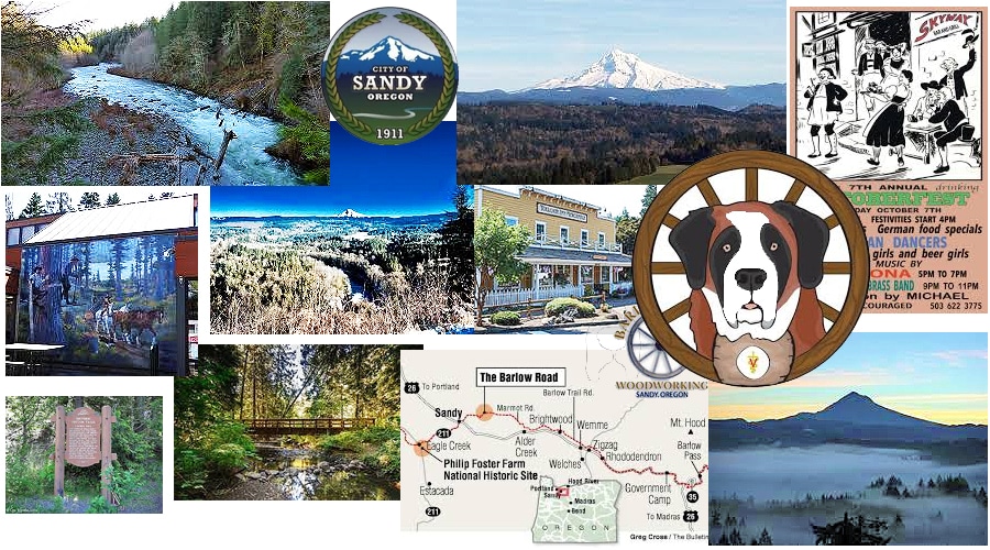
Sandy Oregon is named after the Sandy River that runs through it, which starts up in the foothills of Mt Hood, and runs 56 miles without dams to block it, and flows out into to the Columbia River. There are lots of creeks and rivers in the area, lots of nature and wildlife, and lots of forest and trails! It is a good place to find a little bit of land at a cheaper price, although probably most of it would have trees on it, instead of being pasture or farmland.
Most of the people who live in Sandy Oregon live in the 6 to 8 mile radius around the city, along the well populated rural roads, and roads off Hywy 26, which is the Mt Hood Highway. The weather of Sandy Oregon is cooler than Portland, because of the elevation, and it gets quite a bit more rain, the higher the elevation, the more rain! It is just 30 minutes to Timberline Lodge and skiing, or just 15 minutes to some of the little mountain villages along 26, so if you love going up the the mountains either for skiing, cross country skiing, or just hiking and enjoying the beauty and breathtaking views, this is a wonderful place to live!
Tollgate Inn has alot of history of this area
Sandy Oregon has some colorful history which you can find in the history section of this page. I learned alot of it when we stopped at the Tollgate Inn, which is a pretty good restaurant and baker, but it’s an amazing little museum of the history of this area, the Toll Gate and the Barlow Trail.
They have 3 main festivals during the year.
is an art festival during the summer where over 120 artisans show their wares, and entertainment is provided on 2 stages! Plus lots of good food is available from 20 different food booths, there are trails you can meander on, and a parade with horses, antique cars, floats, and a 5 generation court! Usually 5000 people come to see the parade. The Oktoberfest which celebrates the German Heritage in the area with German food, dancing and beer! The Hometown Holiday Festival and Parade
Sandy River Water Trail is a very unique special part of the Sandy River because it connects parks, open spaces and 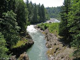 other river access points by water, allowing you to kayak, canoe or paddle the whole thing without running into motor boats! The upper areas of the river actually offer Class IV whitewater rapids in spring and early summer, while in late summer, they go down to flat water Class 1. It takes you through rugged canyons with deep boulders and pools, gravel bars, and beaches. The higher elevations get up to 100 inches of rain, so it can run fast and full!
Tickle Creek Trail is a 1.6 mile trail that follows Tickle Creek through a beautiful 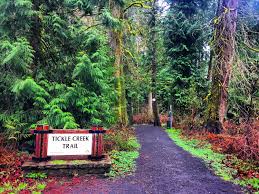 forest with access to Fred Meyer and other shopping as well as neighborhoods, so that people can walk or bike without having to go on HYW 26. The forested trail passes through areas that were logged at the turn of the century with huge notched stumps where they installed wood platforms to manually cut the tree with cross cut saws. Many of these notched stumps have large trees growing on top of them. They are called nurse stumps and nurse logs. There are a few short sections of the trail where you follow a sidewalk, before returning to the trail. You cross Tickle Creek over five large bridges. The trail is six-foot-wide packed gravel which supports families walking, elderly, kids on bikes, and runners. There are a couple of benches for resting. Someday they want to connect this trail to the Springwater Trail that ends in Gresham.
History of Sandy Oregon
This history of Sandy Oregon is fascinating, and is taken from the Toll Gate Inn’s website. I would recommend going there to see all the things they have collected and put on display about the Oregon Trail, Toll Gate and the Barlow Trail!
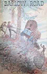
Trials encountered on the Barlow Trail
Many lives were lost in the 1840s on the Columbia River, the only accessible route for emigrant wagons entering the Willamette Valley. Samuel K. Barlow acted on the need for a better route when in 1846 he petitioned the Oregon Provisional Legislature to lay out and build a road from Oregon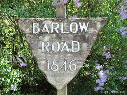 City to the eastern base of the Cascades, and to charge a toll. In partnership with Phillip Foster and a crew of over 40, Barlow began building the road in the spring of that year. When finished the trail cut for over 80 miles through forest, swamps, stream, and hills.
At first, travel on the road was one-way, east to west, and the first toll gate was established at the beginning of the road to Gate Creek at Strickland. Reuben Gant drove the first wagon over the new road in 1846; that year Barlow reported a total of 152 wagons entering the valley via his road and close to 1,600 head of livestock.
After the treacherous descent of Laurel Hill’s steep cliff, travelers still had to ford the Zig Zag and Sandy Rivers. In 1853 Francis Revenue, Sandy’s first settler, built a bridge across the Sandy. This site, a few miles from Marmot, became the new toll gate, counting emigrants from 1853 to 1865. After that the gate was located at Summit House from 1866 to 1870; at Two-Mile camp from 1870 to 1878; and at Toll Gate east of Rhododendron form 1879 to 1915, at which time the Barlow Road passed into the hands of the state of Oregon and the toll gate was removed.
 The toll fee of $5 per wagon seemed outrageous to emigrants arriving at the gate completely destitute. Even after the fee was reduced to $2.50, pioneers unable to pay to cash often paid instead with an article of clothing of an animal. Drivers often sent their livestock around the gate (to the frustration of the gatekeeper), and widows could pass through gree
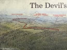
Barlow Trail from beginning to the end, passing through Sandy
The second gate at Revenue’s, now within the city limits of Sandy, was perhaps most symbolic of the end of the long trail. From there it was literally downhill to Foster’s place at Eagle Creek, where pioneers could rest before setting out at a more relaxed pace to stake a claim in the fertile valley. Today the City of Sandy Oregon stands at the gateway to the Portland Metropolitan area and thousands of eastward-bound travelers pass daily a small plaque next to the Sandy City Hall marking the intersection of the Barlow Road with Highway 26.


")


