Surrounded by Northwest Oregon’s coastal mountain range, the town of Clatskanie Oregon is located where the Clatskanie River flows out of the mountains and into the Columbia River.
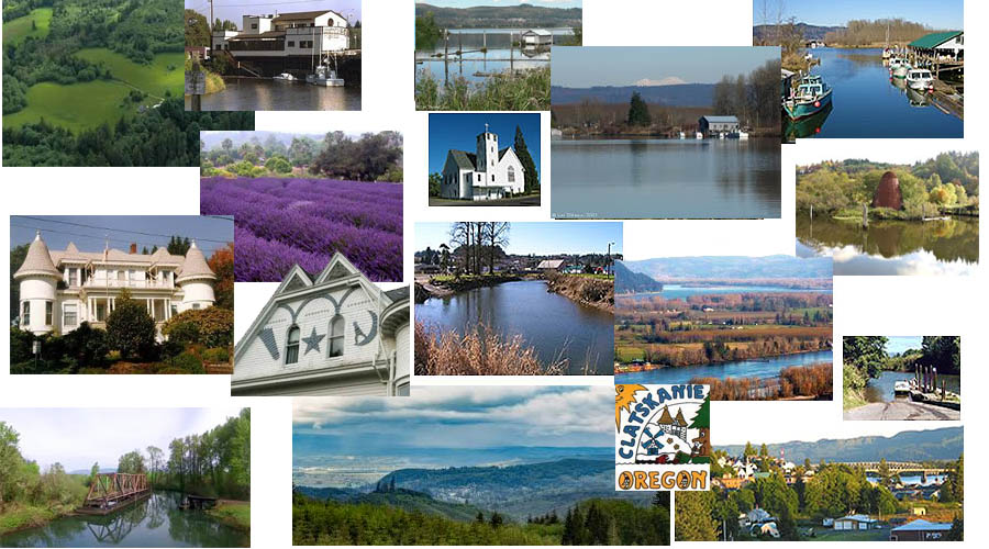
Early pioneers settled here in 1850 – over a century and a half later, it remains a close-knit, friendly community, rooted in its natural resources, but with the promise of new job-creating industries at the nearby Port Westward industrial park. While looking forward to a stronger economy and modest growth in the years to come, the citizens of Clatskanie Oregon share a sense of tradition – multi-generational families, locally-owned small businesses, the preservation and restoration of the town’s historic flavor, community spirit and volunteerism.
One of my favorite places in Oregon is Astoria, where the mighty Columbia flows out into the mighty Pacific Ocean! It is breathtakingly beautiful, 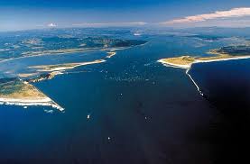 even scary as you see the tides of the ocean hit the outgoing river. Clatskanie is just 35 miles from Astoria. It is up in the hills a little, away from the Columbia River, but it was built on the Clatskanie River right before it reaches the Columbia, and the Clatskanie is a pretty decent size river too. The hills rise up to the south, as you go up into the winding roads of the town, with views as you look back at the valley and river below. On the other side of the Columbia is Washington State, but you can’t get to it unless you take the Astoria Bridge- which is spectacular!
The city of Clatskanie Oregon website describes it as the Norman Rockwell picturesque small city nestled in the green hills and valleys of the coastal range! They have over 70 miles of wonderful calm water in the Clatskanie River and adjacent sloughs that people can swim and kayak in. There are so many outdoor activities to do here, including fishing, hunting, hiking, kayaking, windsurfing and just enjoying nature. There are salmon, steelhead and sturgeon, and trout at Scout Lake, deer, elk, and lots of game birds. One time I was in the area, we were walking along the Columbia River, and all of a sudden a huge eagle swooped down, and landed on a branch about 10 feet above our heads. The branch bent down with it’s weight, and it felt like it was almost on top of us! It was amazing. I never realized how big they were, or that they could land on low branches like that. This area is a wonderful place if you like wildlife and birds!
Many of Clatskanie’s amenities – it’s library and related facilities, swimming pool, ball fields and skate park, veterans memorial, historical museum, the Clatskanie Arts Commission Performing Arts Series, the annual Clatskanie Heritage Days and Bluegrass, Quilt Show, and Lavender celebrations – all have been created and sustained through volunteer efforts and partnerships of local individuals, organizations, businesses and governmental entities working together to enhance of life of the community.
Clatskanie Oregon boasts many vintage buildings and homes, the original building that was built on the river is still in existence! Housing prices are cheaper here because it is so far from Portland. It is also a good place to find a little bit of acreage at a fair price.
Many of Clatskanie’s inhabitants are of Scandinavian heritage, specifically Finnish, Swedish, and Norwegian.
See and Do
Clatskanie is located in the center of sportsman’s paradise. Deer, elk and game abounds. There is a long tradition of salmon, steelhead and sturgeon fishing in the river nearby. Trout fishing is also popular in many of the streams in the area. Pan fish are found in large numbers in the warm tidewaters of the dikelands.
The Ocean beaches and mountain ski slopes are only a little over an hours drive away. Boating and windsurfing are popular sports on the Columbia River. Other activities that Clatskanie Promotes are walking, hiking, bike riding and visiting the local areas of interest.
Columbia River Heritage Canoe Trail ~ Fossil Hunting on Clatskanie River and Conyers Creek ~ Scout Lake ~ Greek Beach ~ Historical Museum
The flippin House – known locally as The Castle.
Carcus Creek Falls: A waterfall from a high basalt shelf. There is no public access road so you have to hike in.
Fox Creek Trail: Includes natural, scenic nature trails excellent for hiking.
Westport Ferry: Operated by Washington State Ferry System, it runs hourly from 7AM to midnight.
Westport Historic Tunnels: Was hewn through a rock ridge to enable pioneers to transport logs and other materials to the river side of the mountain. An Oregonian Historical Marker tells the story.
Bradley wayside and viewpoint: The Hiking Trails offer a birds-eye view of the Wauna paper mill, the Columbia River Islands and the Washington State shore of the Columbia River.
Parks in Clatskanie Oregon
Clatskanie City Park: Includes a swimming pool, well lit sport playing field, playgrounds, horse arena, picnic tables, barbecue facility, boat ramp, camping, canoeing, paddle boating, and restrooms.
Beaver Boat ramp and Park: Includes boarding floats, restrooms and barbecue grills.
Big Eddy Park:Has large fir trees and open grassy play areas. Activities are fishing, canoeing, and a boat launch.
Scaponia Park:This charming, primitive wayside recreational area features a 7 acre nature park.
Mayger Beach: Located near Mayger and used for fishing, swimming and beach activities.
Jones Beach: Includes windsurfing, fishing and recreational use area.
Hudson-Parcher Park: Popular with family groups, sports groups and others looking for peaceful Forest and field campsites. This park offers easy access to fishing, boating and windsurfing in the nearby Columbia River.
Laurel Beach: A day use facility with access to one of the Columbia Rivers many fishing spots and outstanding bird viewing.
Prescott Beach: Hosts one of the Columbia River finest fishing and windsurfing sites. The Park includes a covered picnic shelter, playground, gazebo, horseshoe pit and sand volleyball courts.
History of Clatskanie Oregon
Clatskanie Oregon was named after the Tlatskanai tribe of American Indian, who lived in the hills south of the Clatskanie River in the upper Nehalem Valley. The Tlatskanai, linguistically an Athapascan tribe, originally lived in the flat lands bordering the Chehalis River in Washington State. As game became scarce and their food supply diminished, they left the area, heading south, and crossed the Columbia River to occupy the hills traditionally occupied by the Chinook Indians, who were a large Indian tribe living along the Oregon Coast. After driving away the more peaceful Chinook Indians, the Tlatskanai established themselves within the Clatskanie-Westport area, and extended their numbers into the head of the Nehalem. Tlatskani was a point in the Nehalem River that was reached from the Columbia River by way of the Young’s River or by way of the Clatskanie River. The native inhabitants applied the word Tlatskani to the streams they would follow in order to get to that point, and not the streams themselves, for they were not in the habit of naming the streams. White men carelessly applied this work to the name of the steam. One source lists “Tlatskanai” as meaning “swift running water.” Clatskanie Oregon is indeed a swift beautiful steam. Other names that existed for the Tlatskanai were the Clackstar, Klatskanai and Klaatshan, among others.
The Clatskanie Indians numbers dwindled from smallpox, intermittent fever, warfare, and intermarriage until they numbered only 3 people in a 1910 poll.
White Settlers
On the Lewis and Clark journey maps, Crims Island is shown as a single island and called Fannys Island, while the large elegant bottom on the South side is part of the Clatskanie River/Beaver Slough/Westport Slough flood plain. It is shown on one map as Fannys Valley while another map leaves the island and the bottom unnamed. In their text, Lewis and Clark call this area Fannys Bottom. This is one of the areas that Lewis and Clark explored in their quest to reach the Pacific Ocean.
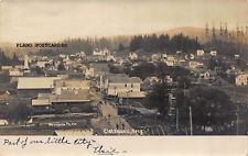 The first person to settle in Clatskanie was Enoch Conyers. He originally came across on the Oregon Trail, heading for California. But along the way, he heard how beautiful and fertile Oregon was, so he changed his mind and went to Oregon. He stayed in Hillsboro in 1852, then in 1853, they bought a squatters right, or Donation Land Claim, for 320 acres in Clatskanie Oregon. They built the first building in Clatskanie right on the banks of the Clatskanie River, which became the General Store, and in 1872 the post office was set up. He also ran a hotel in their home.
In 188o he platted the townsite and the town was born. He also built the first steamboat on the 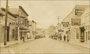 Clatskanie using a big fishing boat that he put a boiler on. They carried freight and passengers and towed things on the river. In 1897 the Astoria and Colubia RR began running from Portland to Astoria, and the area continued to grow. Logging and fishing were prominent in the early days with dairying, mink raising and mint farming later.
Early on, fish seining in the Columbia River, using horses to retrieve the large fishnets full of fish supported various fish stations along the Columbia. Chinese “coolies” were brought in to re-channel part of the Clatskanie River in the 1800’s. During the early 1900’s the lowland areas were diked to create more farmlands and Clatskanie became known as “Little Holland” for a time. The heritage of the Clatskanie 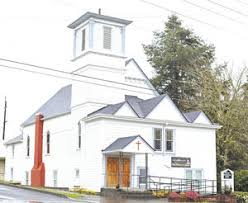 area is largely Scandinavian. Simon Benson began logging the area on the Washington side of the Columbia River then transferred the majority of his operations to the Clatskanie area. Those timberlands are still producing logs on a managed timberland basis by a family connected to the Benson days.
(Taken from the city of Clatskanie.com website)

